Our Services
GEOGRAPHIC INFORMATION SYSTEM
Harness the Power of Location Intelligence to Drive Innovation! As a GIS professional, I leverage advanced spatial technologies to unlock valuable insights hidden in geographic data. My expertise spans across GIS analysis, satellite imagery interpretation, spatial modeling, and map creation. Whether I’m crafting a detailed land use map, conducting terrain analysis, or visualizing complex spatial datasets, my goal is to transform data into powerful tools for decision-making. Let’s navigate the world through the lens of GIS, where every location tells a story.
LAND USE AND LAND COVER ANALYSIS
Overview
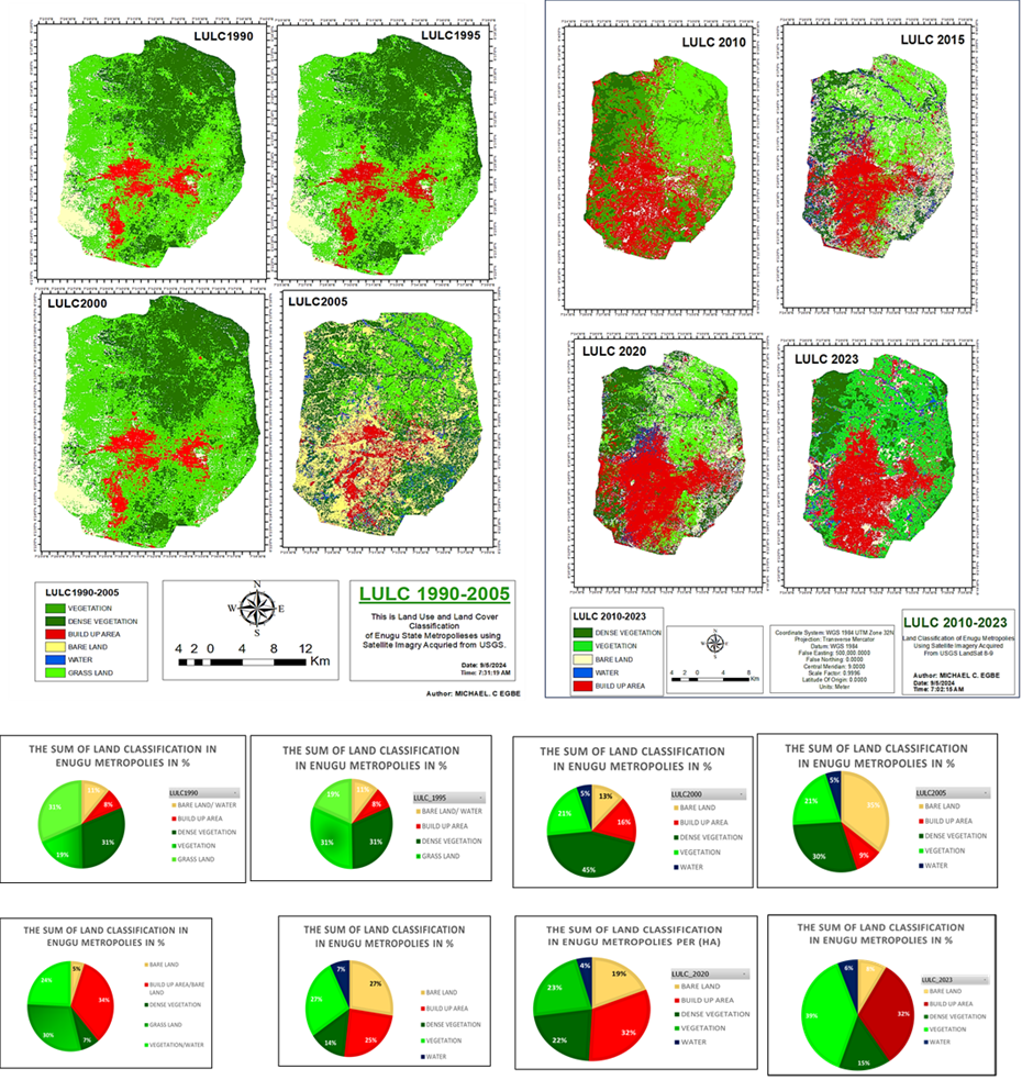
This project provides a detailed analysis of the Land Use and Land Cover (LULC) changes that have occurred in Enugu State Metropolis over a 33-year period (1990–2023).Objective
The primary goal of this project is to:
1.
Assess the spatial and temporal changes in land use and land cover from 1990 to 2023.
2.
Quantify the shifts in key LULC categories such as built-up areas, vegetation, bare land, and water bodies.
3.
Provide data-driven recommendations to guide sustainable urban development and environmental conservation in Enugu Metropolis.
Methodology
Data Collection
Utilized Landsat satellite imagery (1990, 1995, 2000, 2005, 2010, 2015, 2020, and 2023) for the LULC analysis.
Pre-processed data to correct for atmospheric distortions and geometric errors.
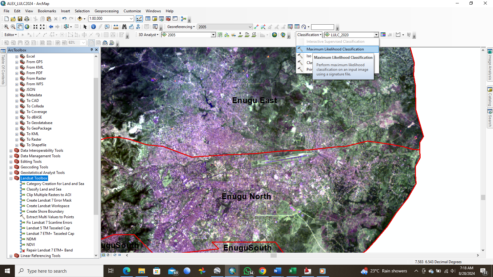
Classification Technique:
Applied Supervised Classification with the Maximum Likelihood Classifier (MLC) in ArcGIS.
Used training samples representing distinct land cover classes (Dense Vegetation, Vegetation, Bare Land, Built-up Area, Water).
Validation:
Conducted accuracy assessments using a confusion matrix and kappa coefficient for each year’s classification to ensure reliability.
Change Detection:
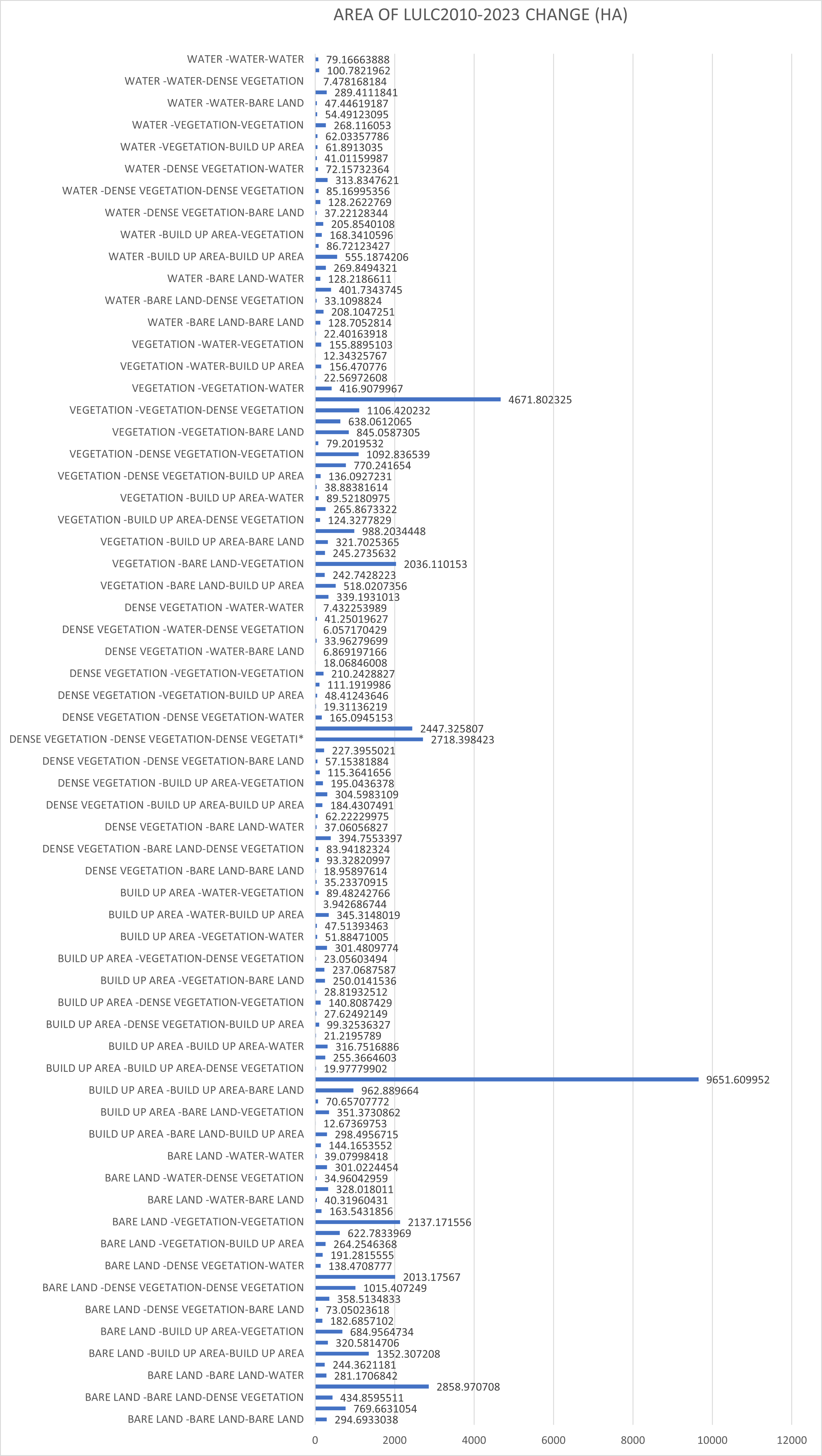
Performed post-classification comparison to calculate the net and proportional changes in each LULC class over the study period.
Findings
LULC Dynamics:
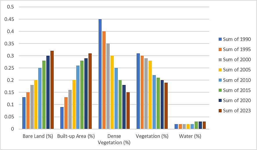
Built-up Areas:
Increased from 9% in 1990 to 31% in 2023, reflecting rapid urbanization.
Dense Vegetation:
Declined significantly from 45% in 1990 to 15% in 2023, indicating deforestation and land degradation.
Vegetation:
Reduced from 31% to 19% over the same period.
Bare Land:
Increased moderately from 13% to 32%, highlighting urban sprawl and construction activities.
Data Collection
Pre-processed data to correct for atmospheric distortions and geometric errors.
Classification Technique:
Validation:
Change Detection:
Findings
LULC Dynamics:
Built-up Areas:
Increased from 9% in 1990 to 31% in 2023, reflecting rapid urbanization.Dense Vegetation:
Declined significantly from 45% in 1990 to 15% in 2023, indicating deforestation and land degradation.Vegetation:
Reduced from 31% to 19% over the same period.Bare Land:
Increased moderately from 13% to 32%, highlighting urban sprawl and construction activities.Water Bodies:
Slight variations were observed, remaining consistent at around 1%.
Graphical Insights:
Pie charts and bar graphs depict the proportional change in each LULC class over time.
The area change chart visualizes the extent of changes in hectares for all LULC categories.
Key Observations:
Urbanization is the leading driver of LULC changes.
Loss of vegetation and open spaces poses environmental challenges such as increased flooding risk and biodiversity loss.
Challenges and Solutions
Challenge: Handling Landsat 7 data gaps due to scan line errors.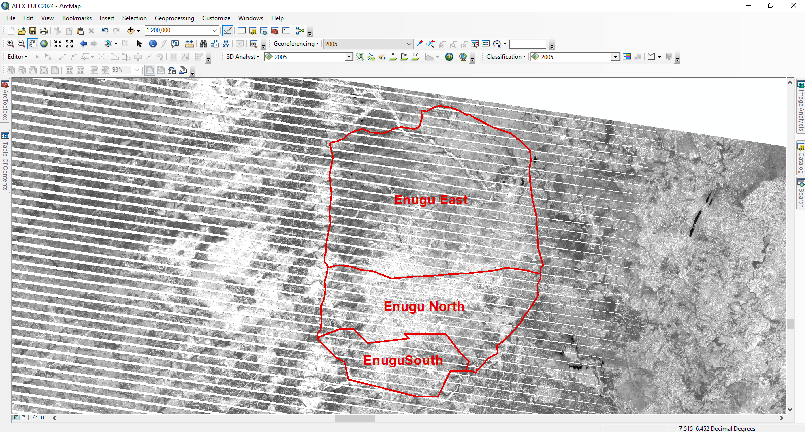
Recommendations
Tools and Technologies
Conclusion
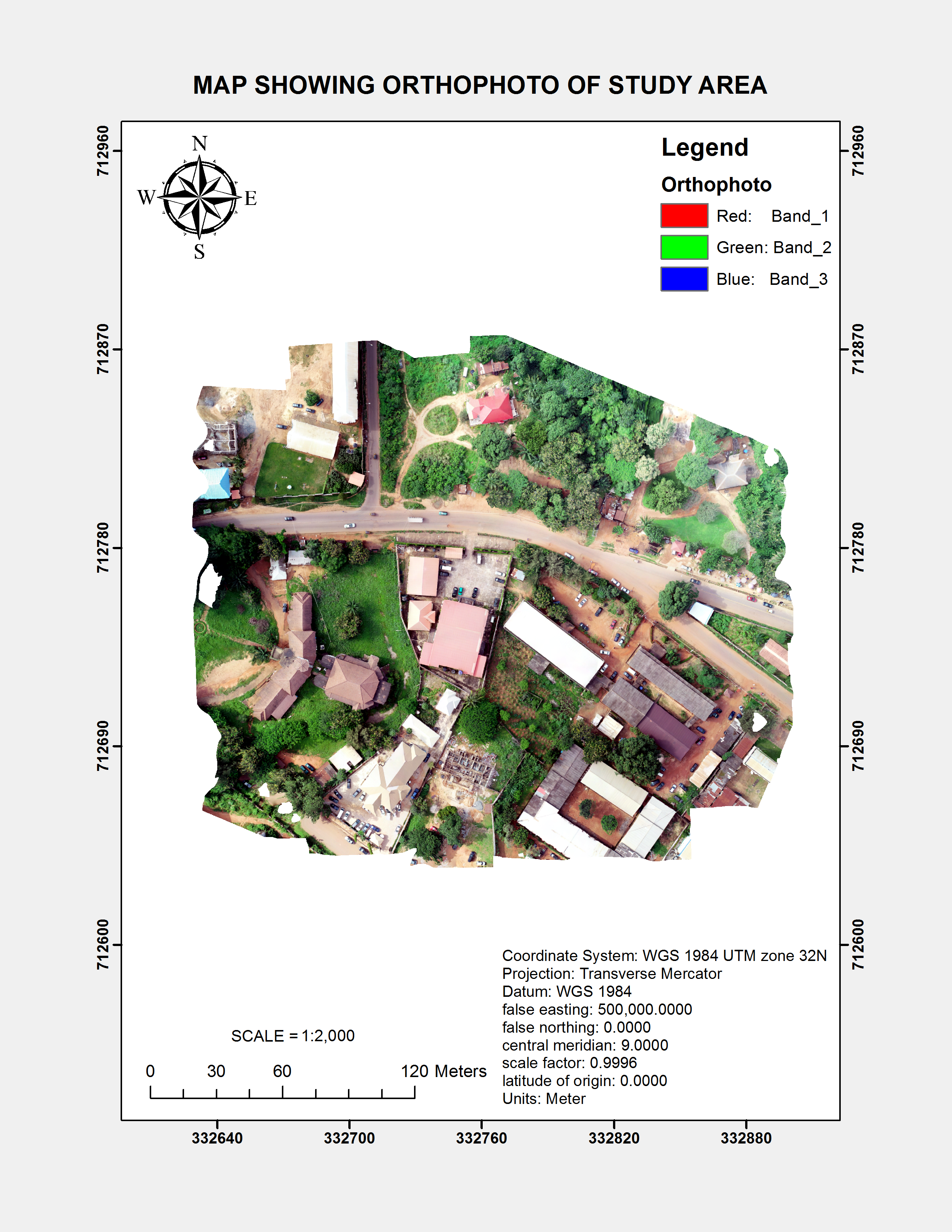
MAPPING AND OTHER GEOSPATIAL ANALYSIS
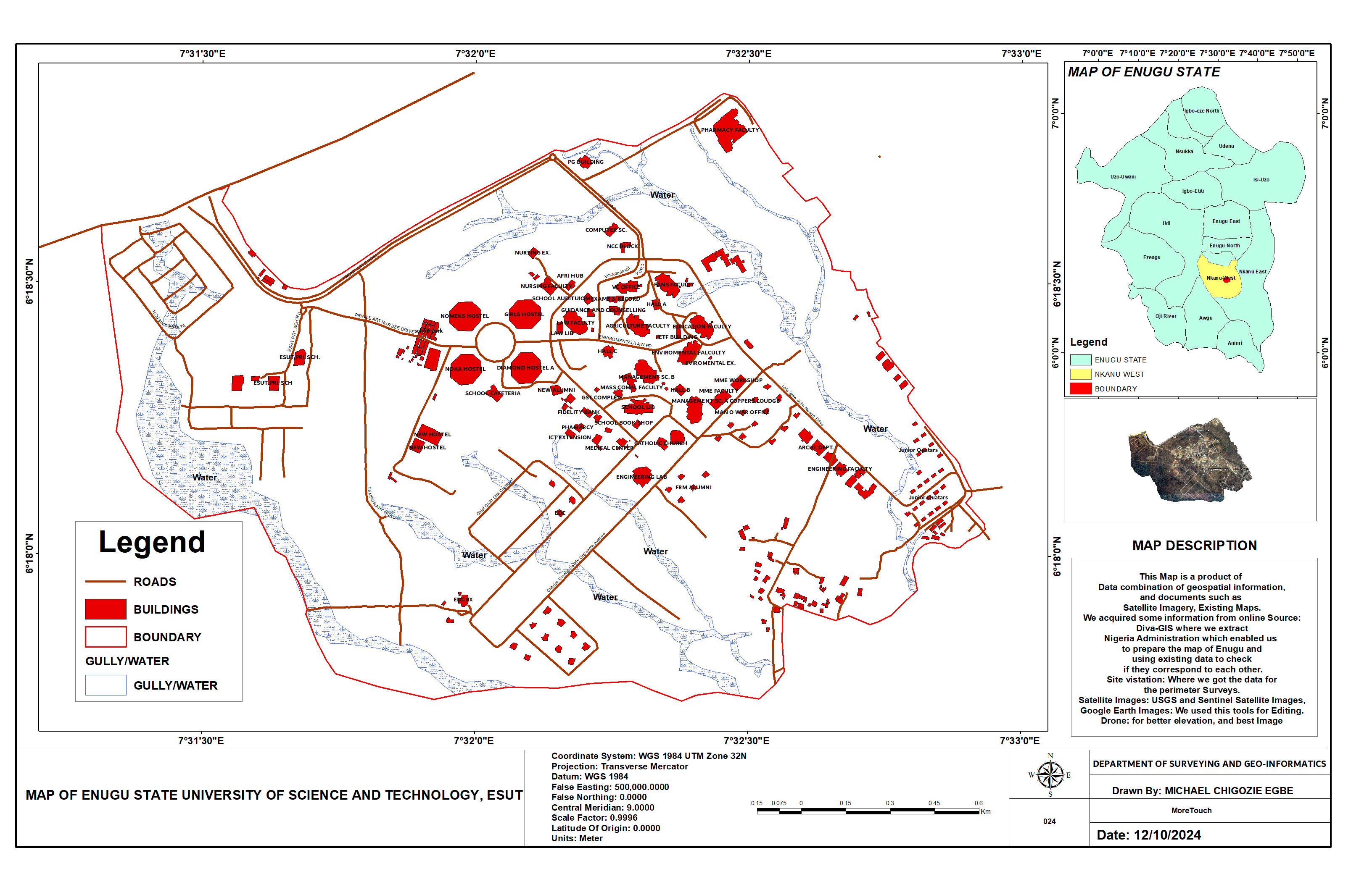
MAP OF ENUGU STATE UNIVERSITY OF SCIENCE AND TECHNOLOGY
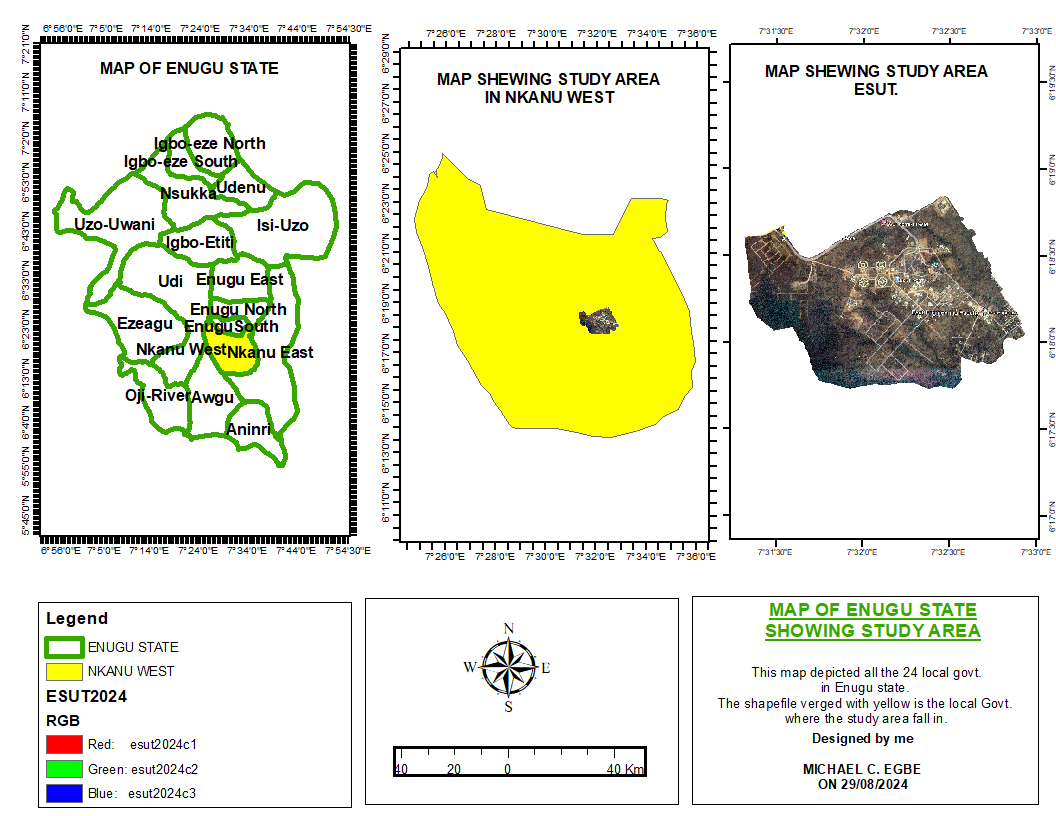
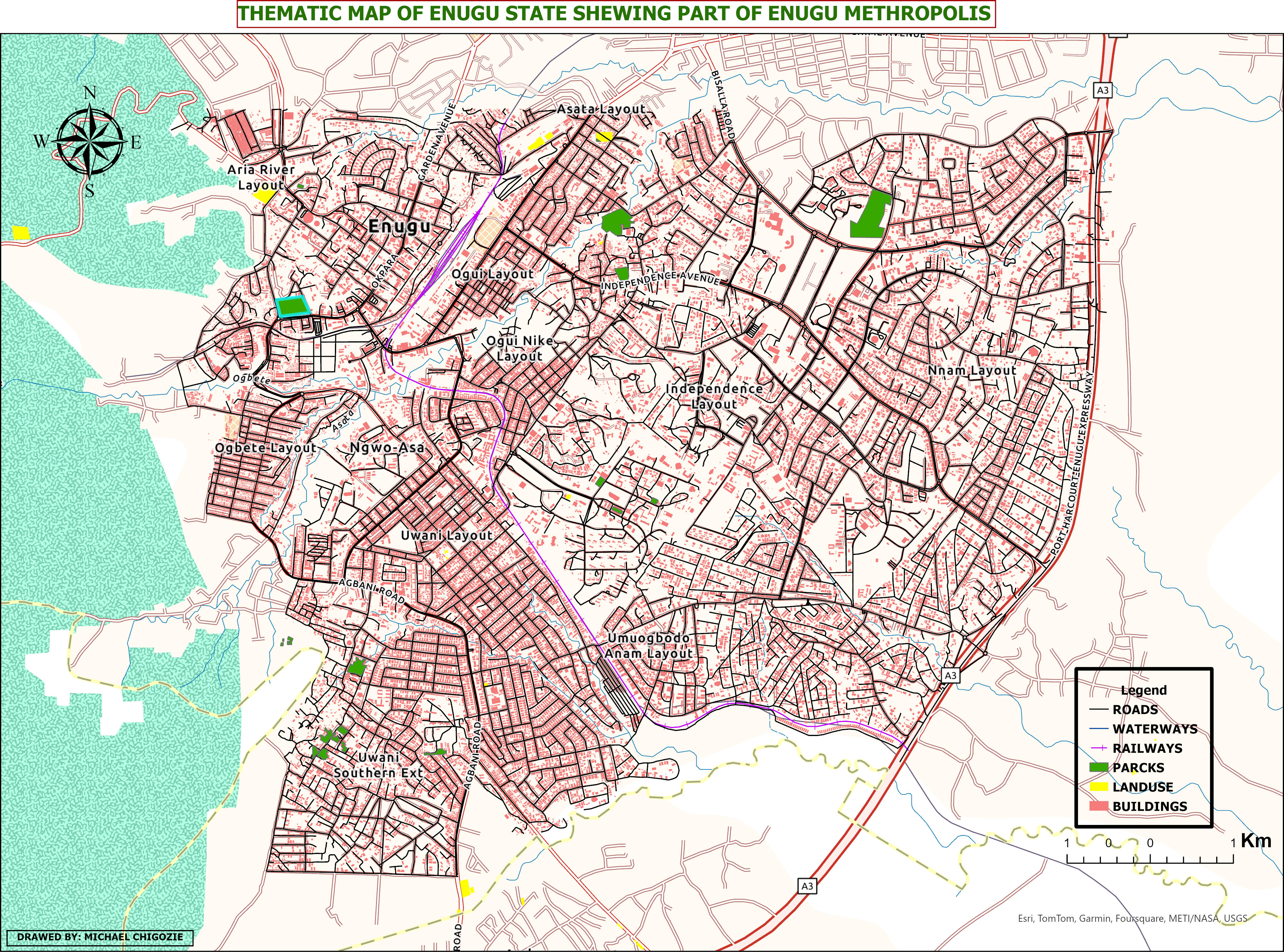
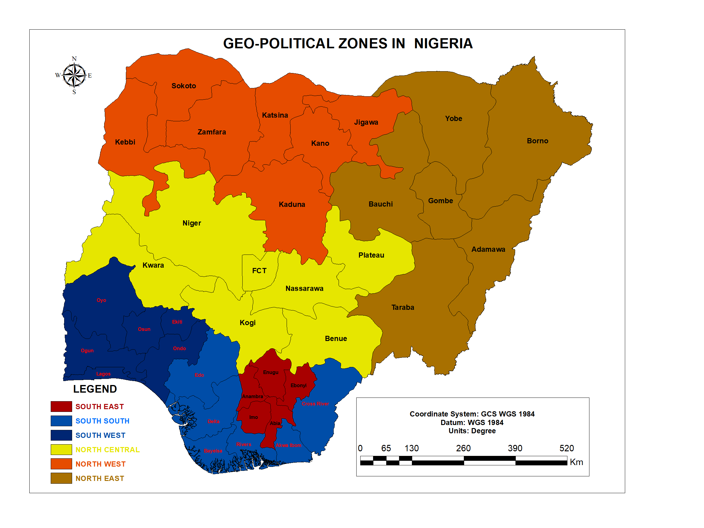
THE MAP OF ENUGU STATE SHOWING THE STUDY AREA
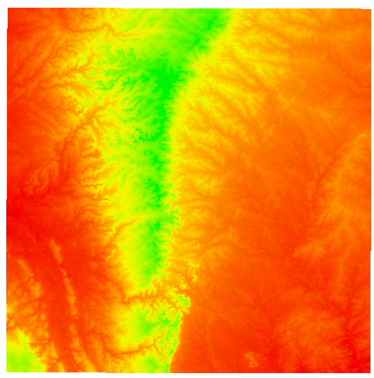
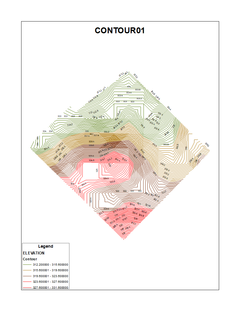
This image focuses on terrain analysis and slope mapping for decision-making in urban planning.
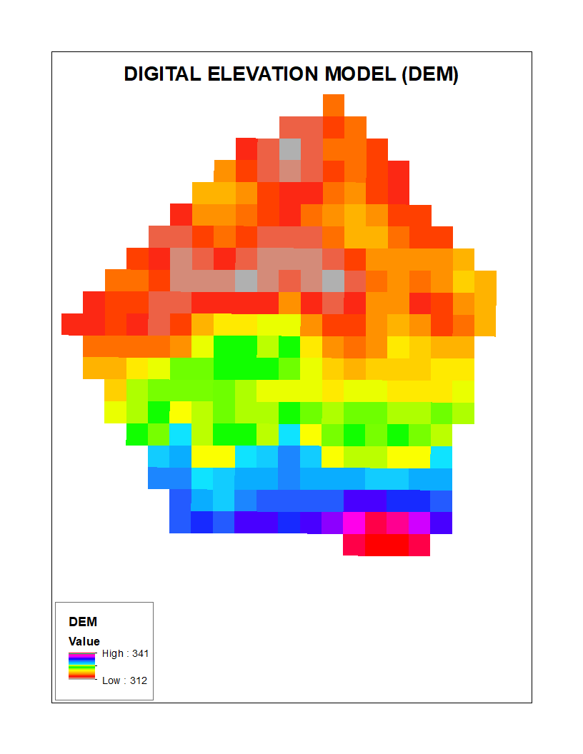
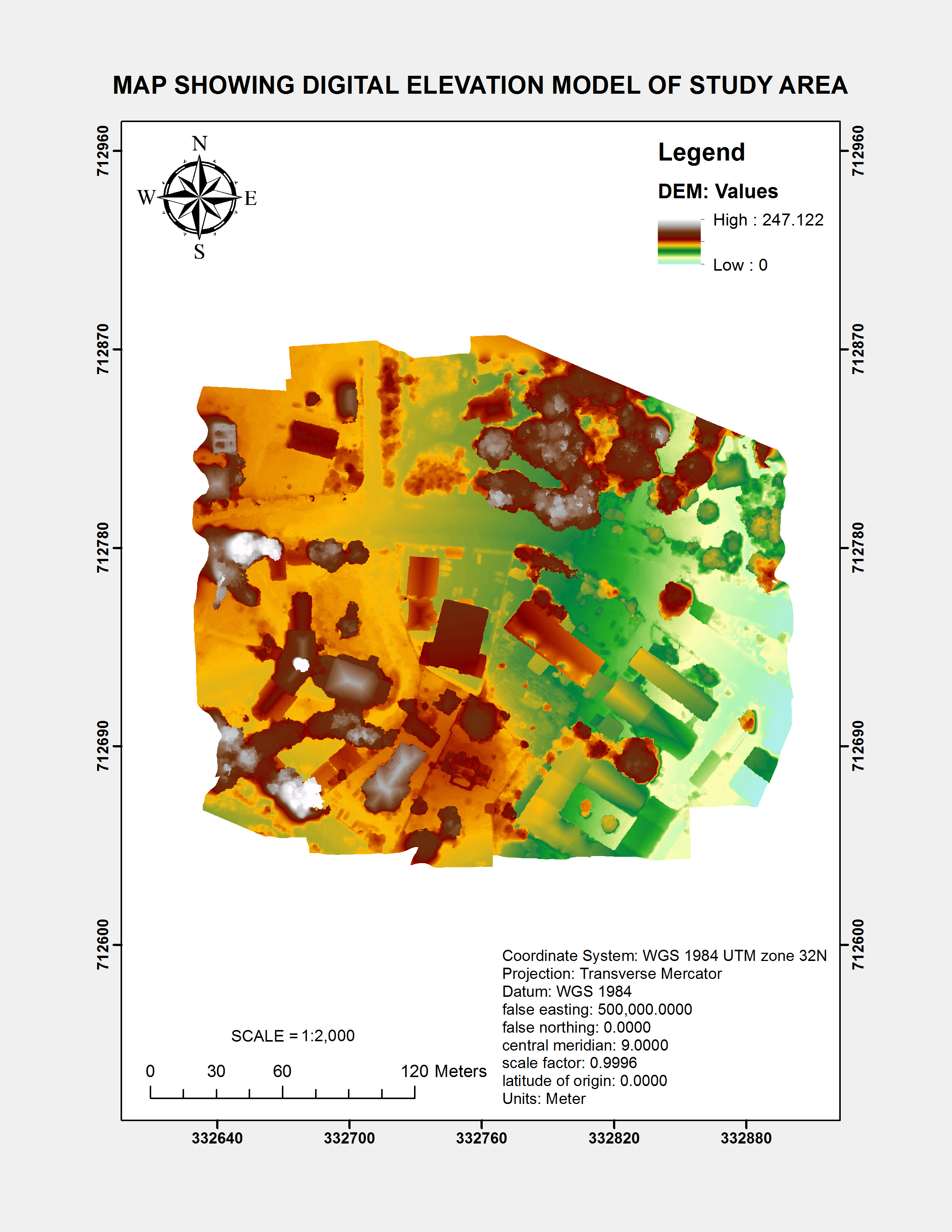
DIGITAL ELEVATION MODEL
DATA ANALYSIS
Turning Data into Actionable Insights for Smarter Decisions! I am passionate about the power of data to solve real-world problems. With my proficiency in tools like ArcGIS, Python, and Excel, I delve into large datasets to discover patterns, trends, and relationships that drive impactful outcomes. From statistical analysis to predictive modeling,
I offer a comprehensive approach to transforming raw data into insights that empower businesses and organizations to make data-driven decisions. Let me help you uncover the hidden potential in your data.
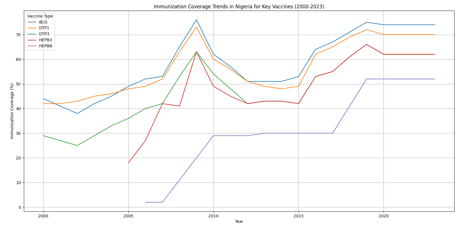
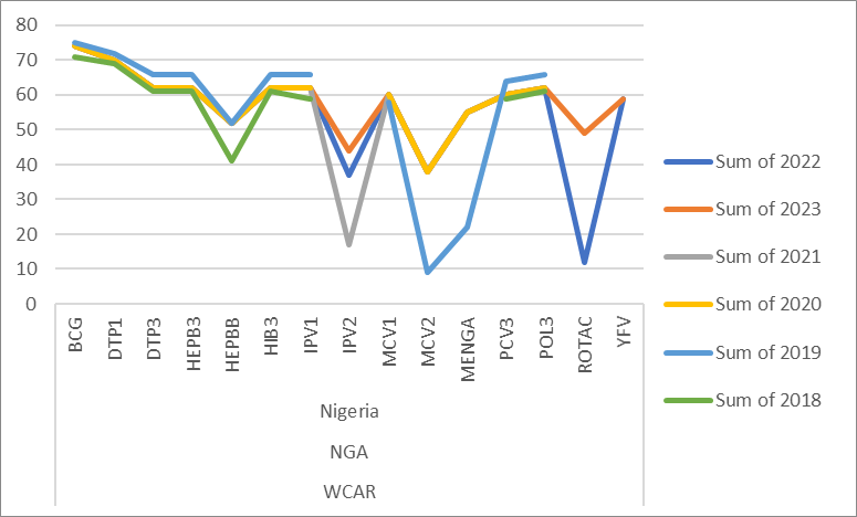
IMMUNIZATION COVERAGE TRENDS IN NIGERIA
This image highlights data trend analysis using Python to identify key insights from large datasets.
IMMUNIZATION COVERAGE TRENDS
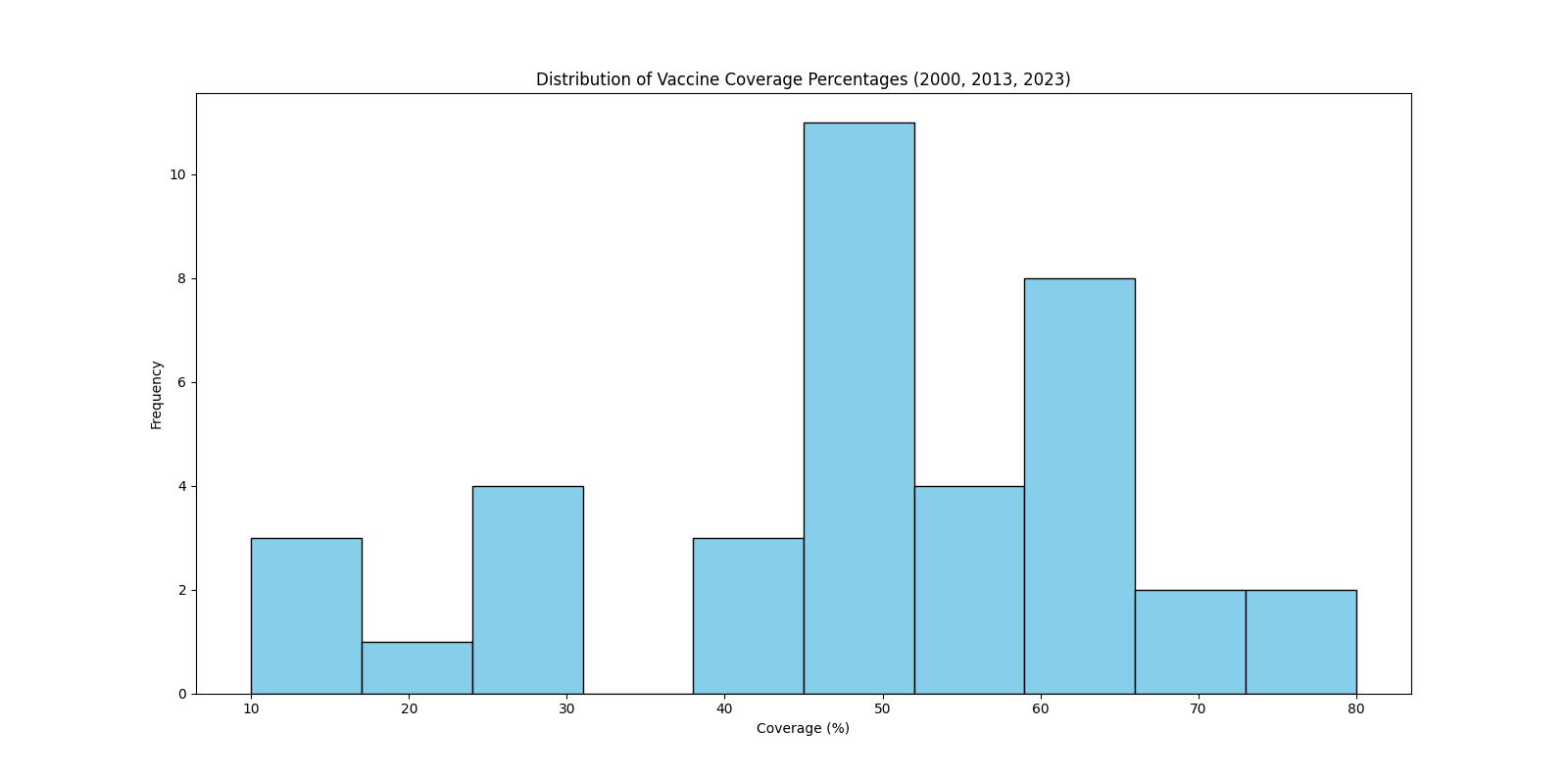
VACCINE DISTRIBUTION TREND PERCENTAGE
IMMUNIZATION COVERAGE TRENDS BY VACCINES 2000-2023
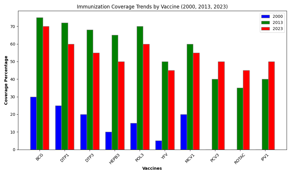
Vaccines Covered:
Trends:
FOOD ANALYSIS
FOOD ANALYSIS
This image represents a statistical correlation analysis using Python, Excel, demonstrating relationships between variables.
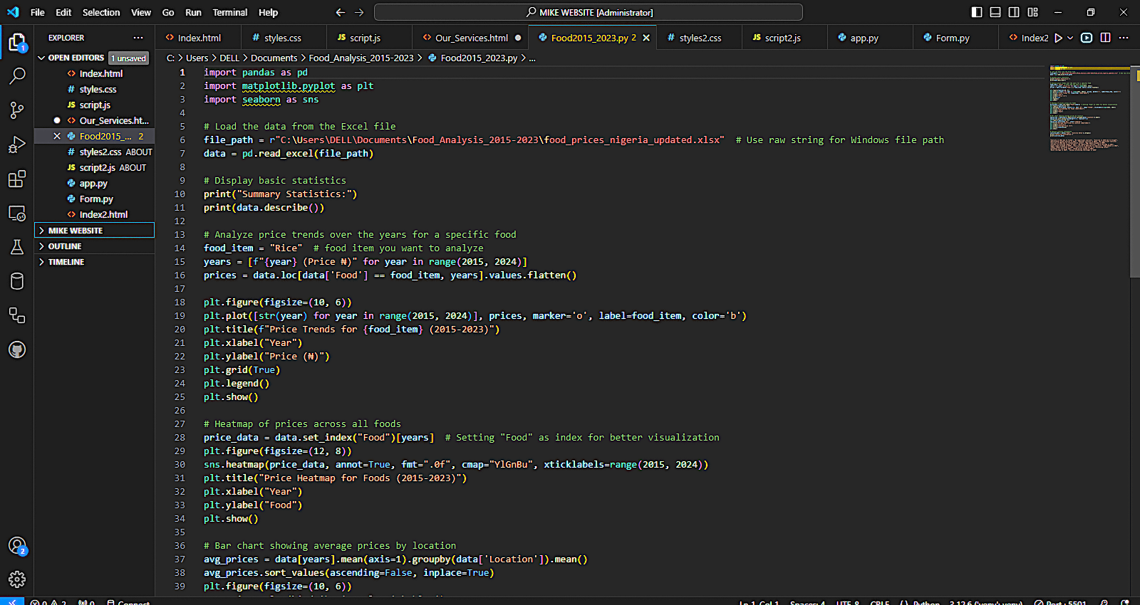
Price Increase for Rice as of Last 8 Years
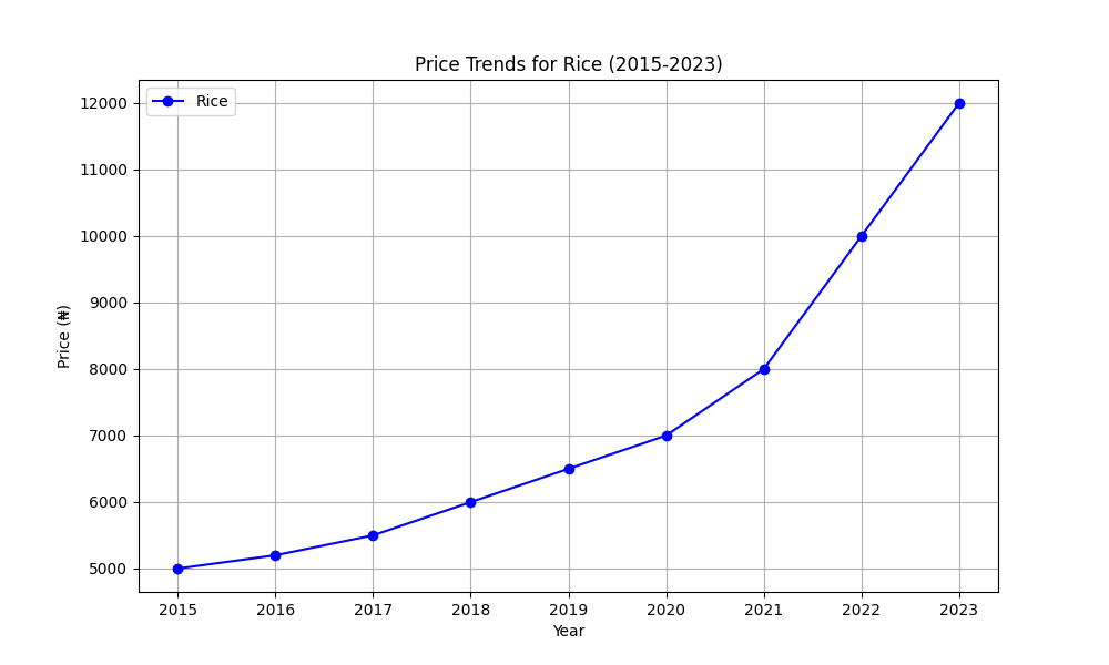
Average Price for Food Stuffs Past 8 Years
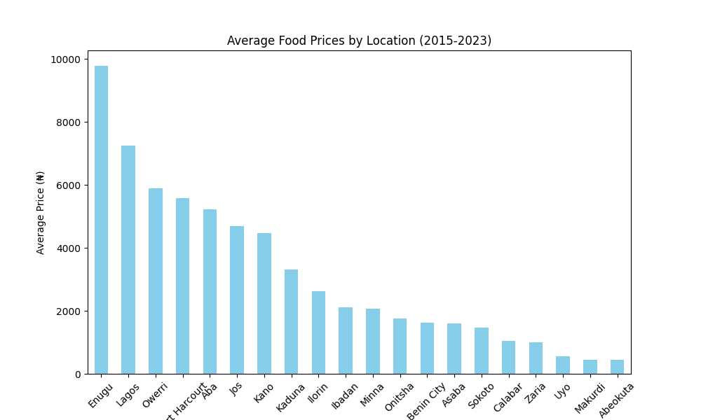
Price Heatmap for Foods (2015-2023)
Analytical Services
Analytical Services for Geospatial and Data Analysis